Soil Moisture Prediction & Irrigation Management
AI-powered soil moisture monitoring and irrigation optimization for sustainable agriculture
AI-powered soil moisture monitoring and irrigation optimization for sustainable agriculture
This startup is associated with the Technology Innovation Hub (TIH) on Positioning and Precision Technologies (PPT) at IIT Tirupati Navavishkar I-Hub Foundation (IITTNiF) through Operation Dronagiri, a flagship initiative of the Department of Science & Technology (DST) Geospatial Data Promotion and Development Committee (GDPDC) and the Geospatial Innovation Cell (GIC) under the National Geospatial Policy (NGP).
Operation Dronagiri demonstrates the power of geospatial technology in transforming Agriculture, Transportation & Infrastructure, and Livelihood & Skilling, aligning with the national vision of Viksit Bharat 2047.
The initiative is powered by the Geo-Intel Lab, the Geospatial Intelligence and Applications Laboratory of IITTNiF, which develops applications and platforms for public good and digital governance. The lab integrates GIS, Remote Sensing, GNSS, and Data Analytics to deliver scalable decision-support systems and hosts India's first Federated Geospatial Data Interface (GDI) node, enabling seamless data access and collaboration across the national geospatial ecosystem.
All products and platforms developed under this collaboration will be featured on the National Geo-Intel Portal
Agricultural water management faces significant challenges due to unpredictable weather patterns and inefficient irrigation practices. Farmers need accurate, real-time data on soil moisture levels to optimize water usage and improve crop yields while conserving precious water resources.
IIT Tirupati
Vizianagaram, Andhra Pradesh
Our solution leverages advanced geospatial technologies including SAR (Synthetic Aperture Radar) satellite imagery, machine learning algorithms, and ground-truth validation to provide accurate soil moisture predictions. By integrating multi-temporal satellite data with field measurements, we develop predictive models that help farmers make informed irrigation decisions. The system analyzes soil conditions, weather patterns, and crop requirements to generate actionable insights delivered through a user-friendly decision support tool.
Week 1-8
Field campaigns finished with comprehensive data collection
CompletedWeek 9-12
ML field segmentation model completed with successful testing
CompletedWeek 13-18
Field visits, data collection, and validation activities
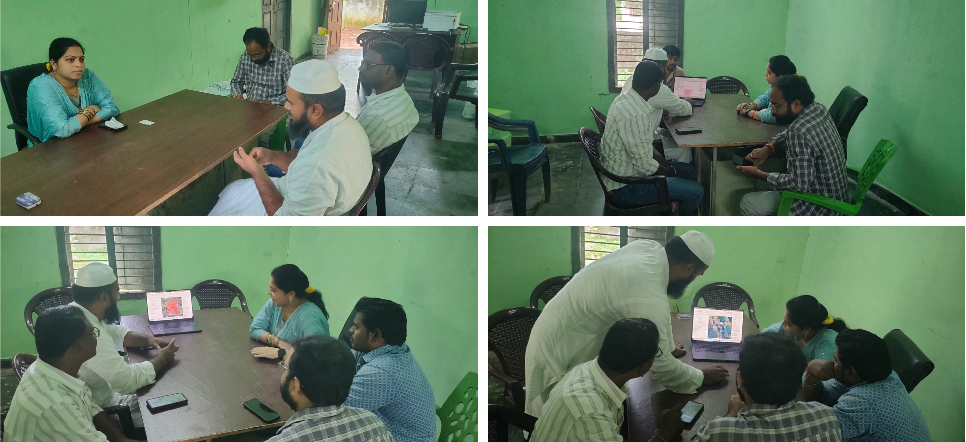
Ground truth measurements and sensor deployment
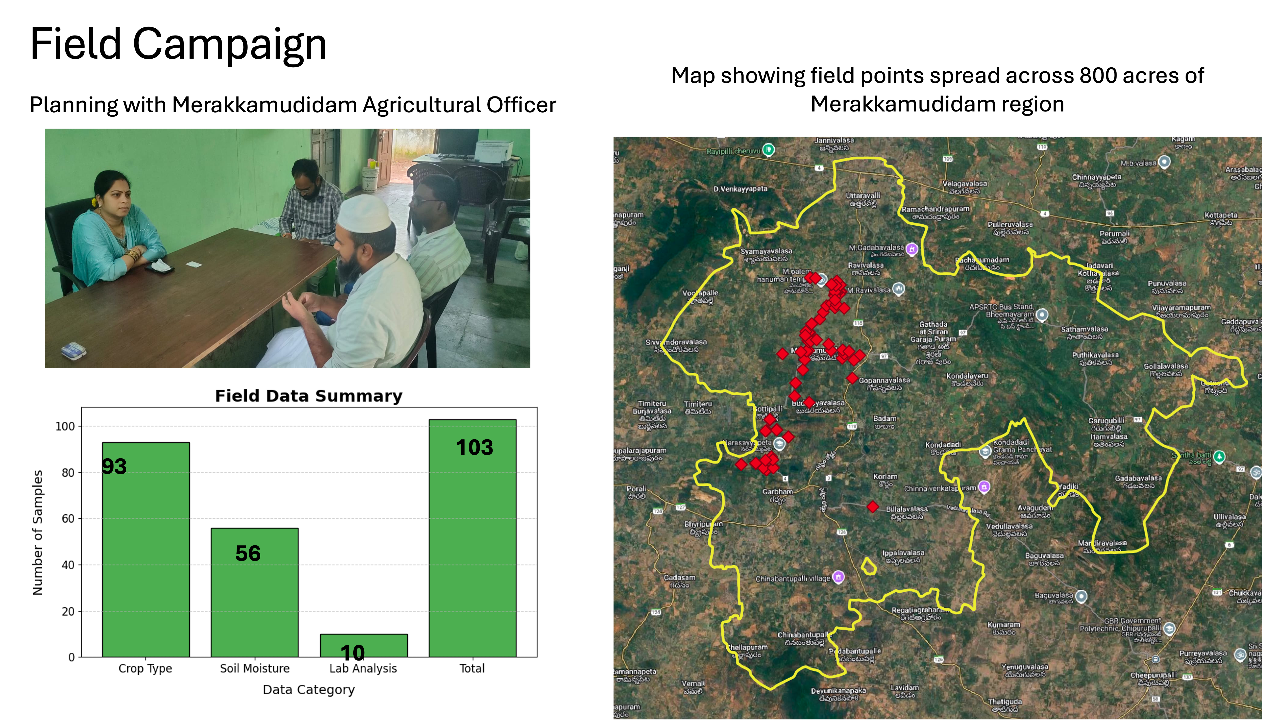
Collaborative data gathering with agricultural experts
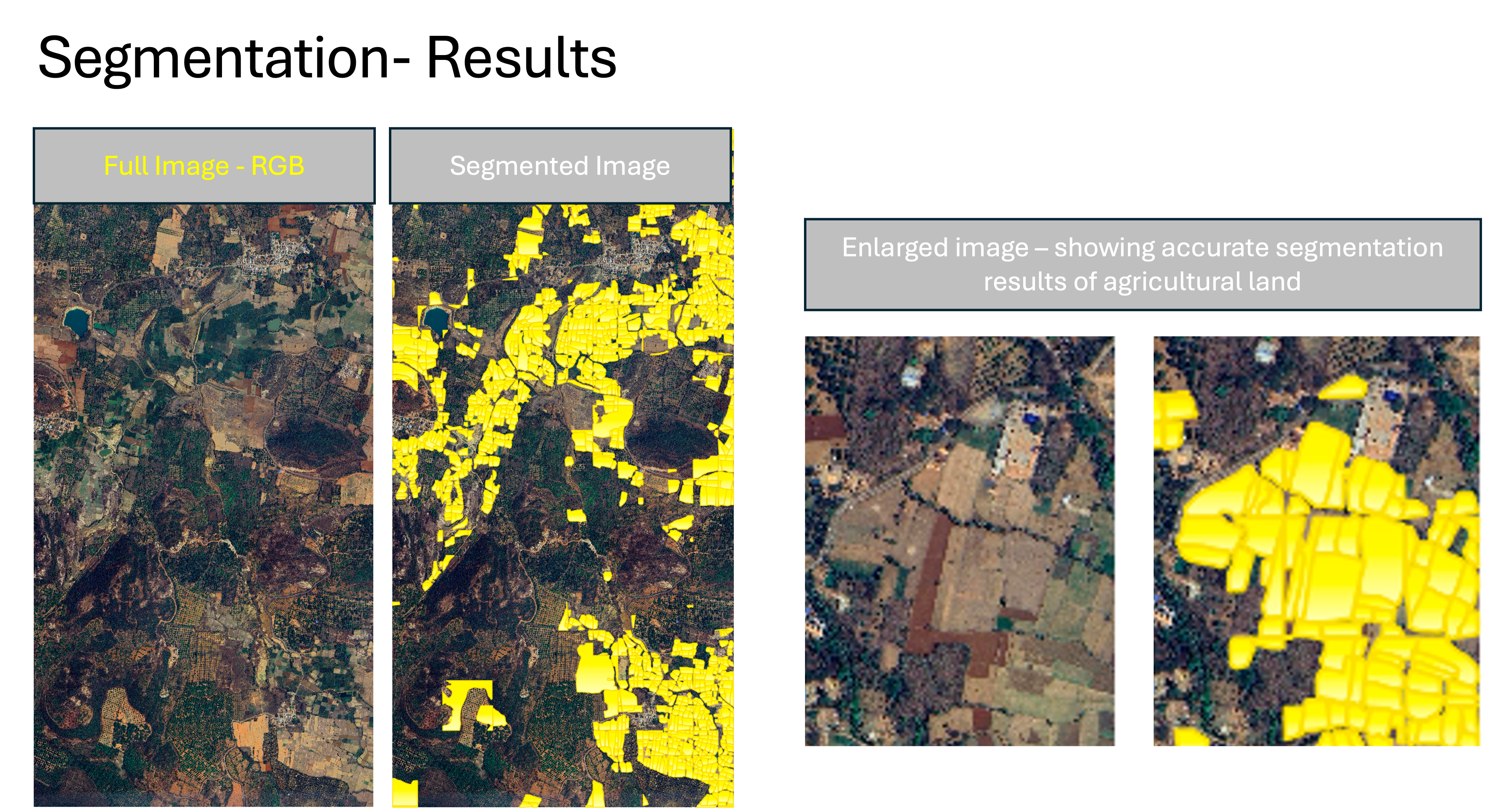
Automated field boundary detection and crop classification
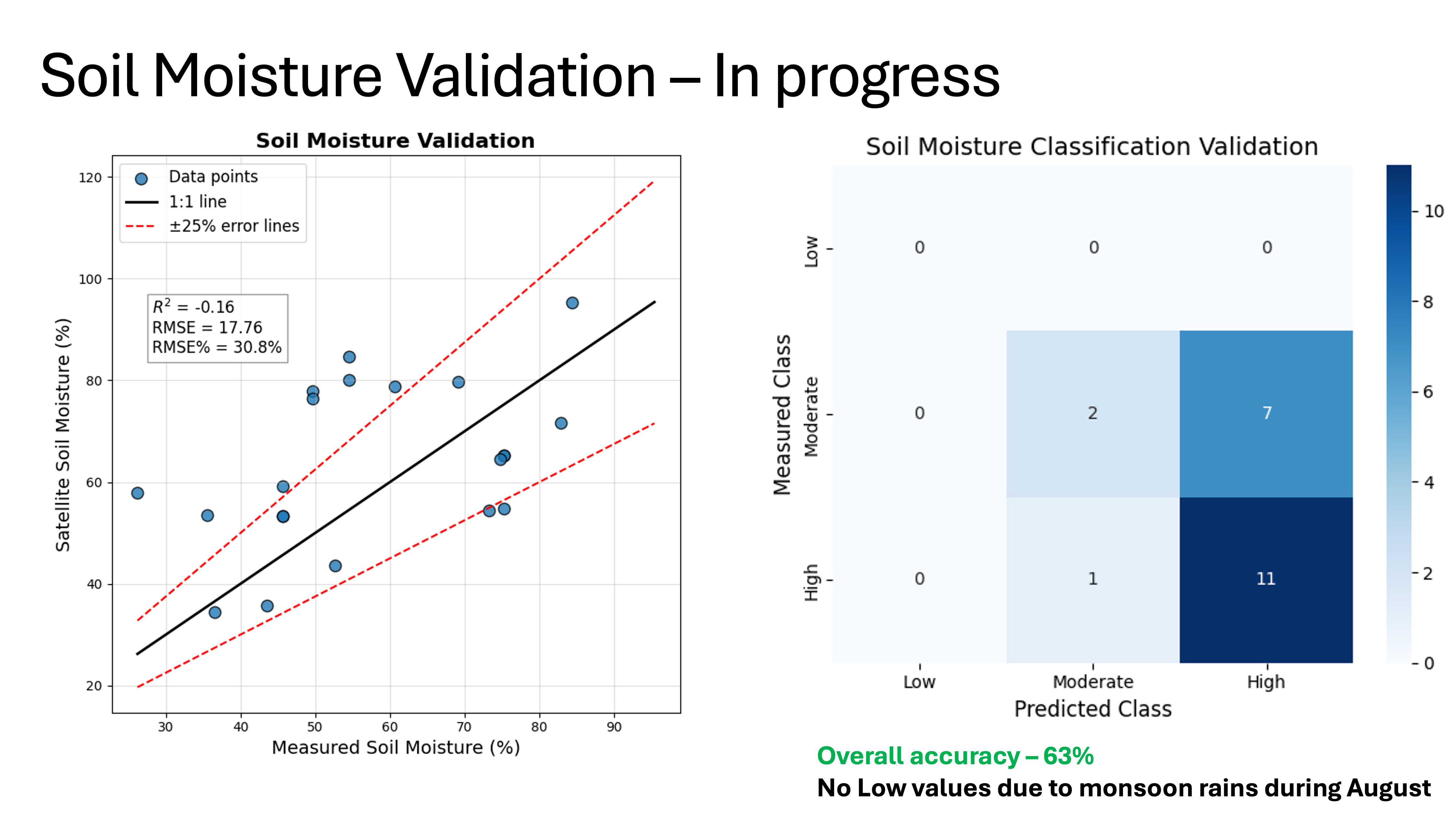
Comparison of satellite-derived and ground measurements
Prototype demonstration of the irrigation decision support tool
Completed
Project Lead & ML Engineer
Specializes in machine learning applications for remote sensing and geospatial data analysis. Leading the development of soil moisture prediction models and decision support systems.
Project Assistant
Expert in forest and agriculture field works, data collection, data collation and logistic planning. Assists the team in collection of ground truth points and data labellig
Expected reduction in water usage through optimized irrigation scheduling, helping conserve precious water resources while maintaining crop health.
Improved crop yields through data-driven irrigation decisions, ensuring optimal soil moisture levels at critical growth stages.
Providing farmers with accessible, actionable insights to make informed decisions about irrigation timing and water allocation.
Contributing to long-term agricultural sustainability by promoting efficient resource management and reducing environmental impact.
Complete model validation with new data from diverse agricultural regions and crop types
Finalize the user-friendly decision support system with mobile and web interfaces for farmers
Deliver comprehensive final report and prepare for scaling to additional districts and states
Full integration with the National Geospatial Data Interface for broader accessibility
This project contributes to the following UN Sustainable Development Goals:
Zero Hunger
Clean Water & Sanitation
Responsible Consumption
Climate Action
Connect with us to explore collaboration opportunities or learn more about Operation Dronagiri